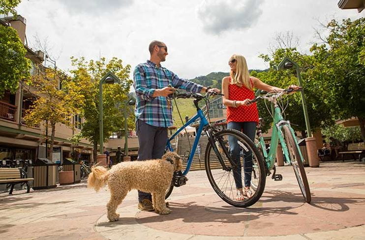
Aspen's Most Popular Bike Routes
Aspen Snowmass is a great place to explore all types of riding, for all types of abilities.
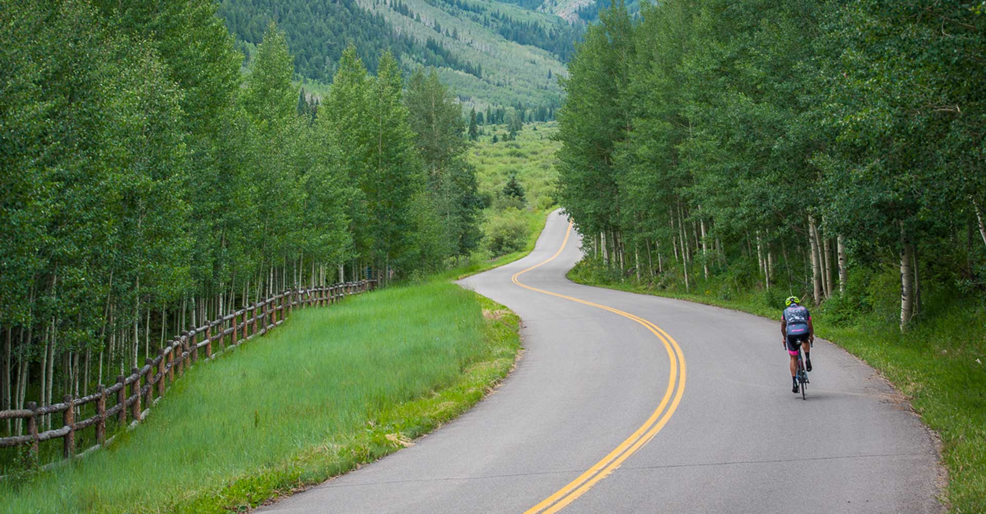
Below are 20 of Aspen's most popular bike routes, with options for dropping off your bike on a one-way ride, made possible by Four-Mountain Sports (learn more below).
Routes From Aspen
Aspen > Snowmass Base Village (Via Owl Creek)
Distance: 9.8 miles | Difficulty: Moderate | Elevation Gain: 1,070 feet | Type: Paved trail & road
Best for: Scenic valley views, families, casual riders
Terrain: Gradually climbing with scenic ranch land
There are two primary routes for cycling between Aspen and Snowmass Base Village, with the Owl Creek route being more direct and shorter by a mile. This ride goes by the airport and some scenic ranch land, with a gradual but steady climb of 1,070 feet to the Base Village.
Aspen > Snowmass Base Village (Via Brush Creek)
Distance: 10.8 miles | Difficulty: Moderate | Elevation Gain: 1,200 feet | Type: Paved trail & road
Best for: River scenery, steady climbers, scenic views
Terrain: Long downhill, then moderate climb
The alternative route to Snowmass Base Village follows the Rio Grande Trail along the Roaring Fork River to Brush Creek Road. Compared to Owl Creek, it is a mile further, and offers a long, steady downhill before a moderately strenuous climb up to Snowmass. Views on the final approach are glorious.
Aspen > Woody Creek Tavern
Distance: 7.8 miles one-way | Difficulty: Easy | Elevation Gain: Minimal | Type: Paved multi-use path
Best for: Families, casual riders, first-timers, dining destination
Terrain: Mostly downhill cruise
One of the most popular day trips in the valley consists of a steady downhill cruise along the Rio Grande Trail to the legendary Woody Creek Tavern. This former grocery store and post office turned rustic, funky tavern has long played host to an eclectic assortment of locals, cyclists and celebrities, and was perhaps best known as the preferred hangout for writer Hunter S. Thompson.
Woody Creek Tavern > Aspen
Distance: 8 miles | Difficulty: Moderate | Elevation Gain: 400 feet | Type: Paved multi-use path
Best for: Return riders, steady climbers, post-lunch workouts
Terrain: Steady climb along the Roaring Fork River
After a few rounds of tamales at the Woody Creek Tavern (or the New Mexico-style green chile and pork), you may want to burn off some calories by earning your way back to Aspen. The 8-mile return trip climbs steadily up the Roaring Fork River, but is manageable for many.
Aspen > Maroon Bells
Distance: 11.5 miles one-way | Difficulty: Challenging | Elevation Gain: 1,800 feet | Type: Paved road
Best for: Experienced riders, photographers, bucket-list rides
Terrain: Steep climb through forest to alpine lake
We try not to be prone to hyperbole, but this really is one of North America's greatest rides. The ascent can feel steep as you climb up Maroon Creek Road, but the payoff — the moment you turn the corner and sneak a peak of "the Bells" for the first time — is richly rewarding. Because of the 1,800-foot climb, consider renting an e-bike.
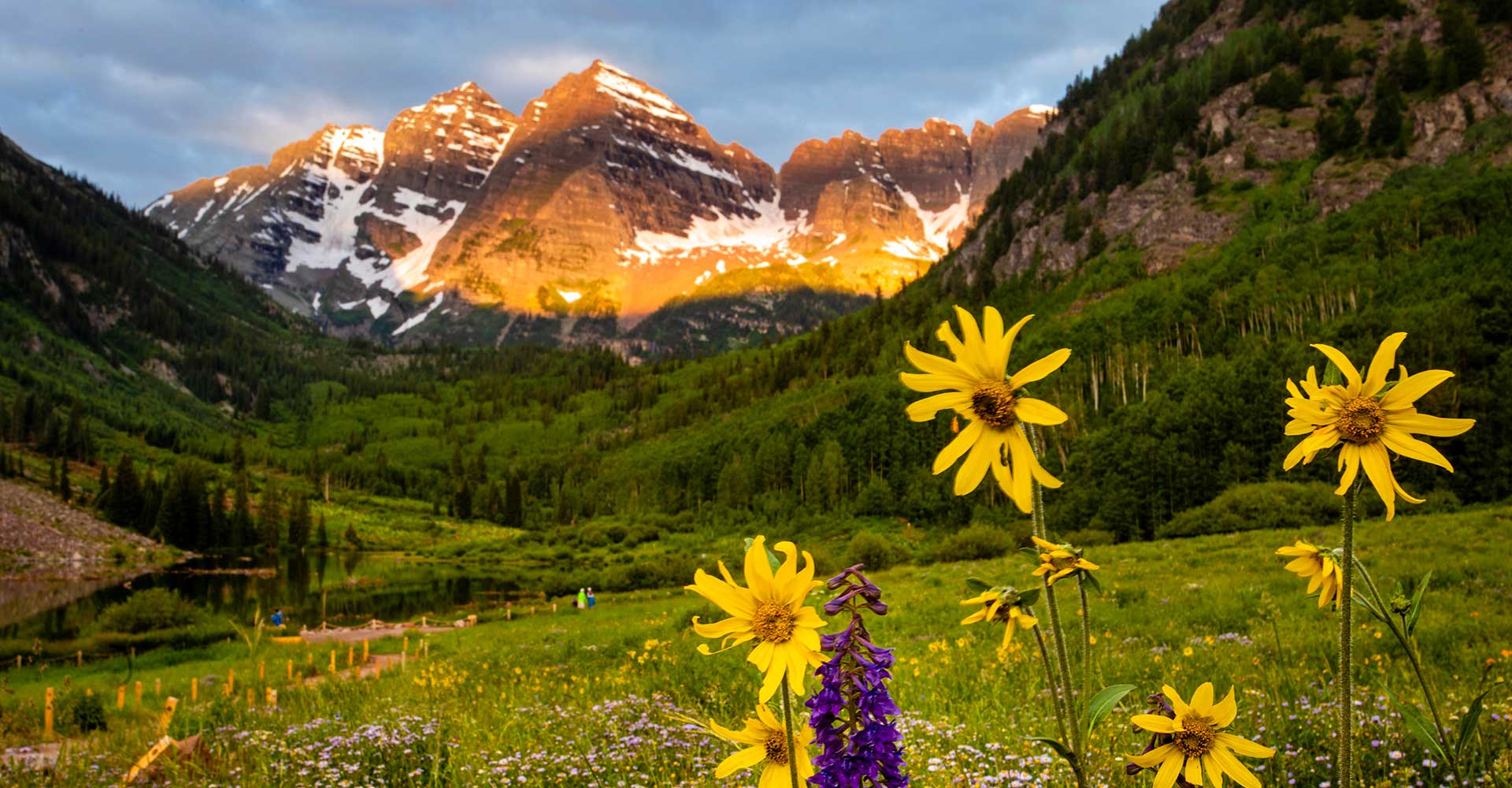
Maroon Bells in summer with flowers
Maroon Bells > Aspen
Distance: 11.5 miles one-way | Difficulty: Easy to Moderate | Elevation Loss: 1,800 feet | Type: Paved road
Best for: Descent riders, scenic cruising, rewarding downhill
Terrain: Fast descent through aspen forest back to town
Another reward for pedaling all the way up to Maroon Lake and the Bells? The descent down, which is a thrilling ride through groves of aspens. In fact, don't be surprised if the return ride to Aspen takes half as much time. However, be mindful of your speed on the way down as it is easy to go too fast. And of course: wear a helmet!
Aspen > The Tipsy Trout (in Basalt)
Distance: 19 miles one-way | Difficulty: Easy to Moderate | Elevation Gain: Minimal | Type: Paved multi-use path
Best for: Half-day adventures, families, dining destinations, one-way riders
Terrain: Nearly flat with easy-going vibes
For a solid but not-too-challenging workout, consider this ride down the Rio Grande Trail to the lovely community of Basalt and its signature riverside café, The Tipsy Trout. Given this ride's nearly 20-mile length, you may want to utilize Four Mountain Sports bike drop service as well as the easy-peasy RFTA buses back to Aspen. Of course, you can also book shuttle options for the return.
The Tipsy Trout > Aspen
Distance: 19.7 miles | Difficulty: Moderate to Challenging | Elevation Gain: 1,389 feet | Type: Paved multi-use path
Best for: Strong riders, full-day adventures, return cyclists
Terrain: Mostly flat with steady climbing
... But, if your al fresco lunch has reinvigorated you for the ride back (the beautiful Frying Pan River does have a restorative effect on many!), then you can easily cycle back the way you came. The 19.7-mile ride is mostly flat, but their is a steady gain of 1,389 feet to get back to Aspen. (We did the math: that's only 70 feet per mile. You got this!)
Aspen > Lenado
Distance: 16.2 miles one-way | Difficulty: Moderate to Challenging | Elevation Gain: 1,200 feet | Type: Paved trail, unpaved road
Best for: Solitude seekers, experienced riders, wilderness access
Terrain: River-side riding, unpaved forest road climb
One of the less-obvious (but no less beautiful) bike trips in the valley leads to the northern edge of the Hunter/Frying Pan Wilderness. To reach the settlement of Lenado, riders follow the Rio Grande Trail to Woody Creek, then proceed up the unpaved Woody Creek Road. Cell service is spotty back here, so load your route before you leave Aspen.
Lenado > Aspen
Distance: 16.2 miles one-way | Difficulty: Moderate | Elevation Gain: Minimal (mostly downhill) | Type: Paved trail, unpaved road
Best for: Solitude seekers, scenic return rides
Terrain: Mostly downhill with forest immersion
The return trip from Lenado to Aspen is 16.2 miles. When combined with the Aspen to Lenado leg, it creates one of the most esteemed routes in the valley for the local cycling community: a 30+ mile roundtrip ride along rivers, creeks, forest and open space. Mountain views abound.
Aspen > Independence Pass
Distance: 21 miles | Difficulty: Very Challenging | Elevation Gain: 4,100 feet | Type: Paved road
Best for: Experienced cyclists, bucket-list rides, high-altitude training
Terrain: Steady alpine climb to 12,095-foot summit
One of Colorado's most iconic cycling routes. Relentless climbing through aspen forest, subalpine pine, and above-treeline tundra. Summit views span the Continental Divide.
Pro tips: Start before 7 AM to avoid storms. Bring 3+ liters of water and a windproof jacket. Summit is 40–50°F even in summer.
Independence Pass > Aspen
Distance: 21 miles | Difficulty: Moderate | Elevation Loss: 4,100 feet | Type: Paved road
Best for: Descent junkies, thrill-seekers, rewarding downhill run
The payoff ride. After conquering the climb, earn 4,100+ feet of exhilarating descent back to town. The full Aspen > Independence Pass > Aspen loop takes 4–6 hours and ranks among Colorado's premier cycling challenges.
Technical notes: Steep descent requires good braking control. Watch for gravel on curves. Oncoming traffic possible.
Pro tips: Use brakes strategically on steep sections. Watch for loose gravel on corners. Stay aware of traffic.
Bike Rentals
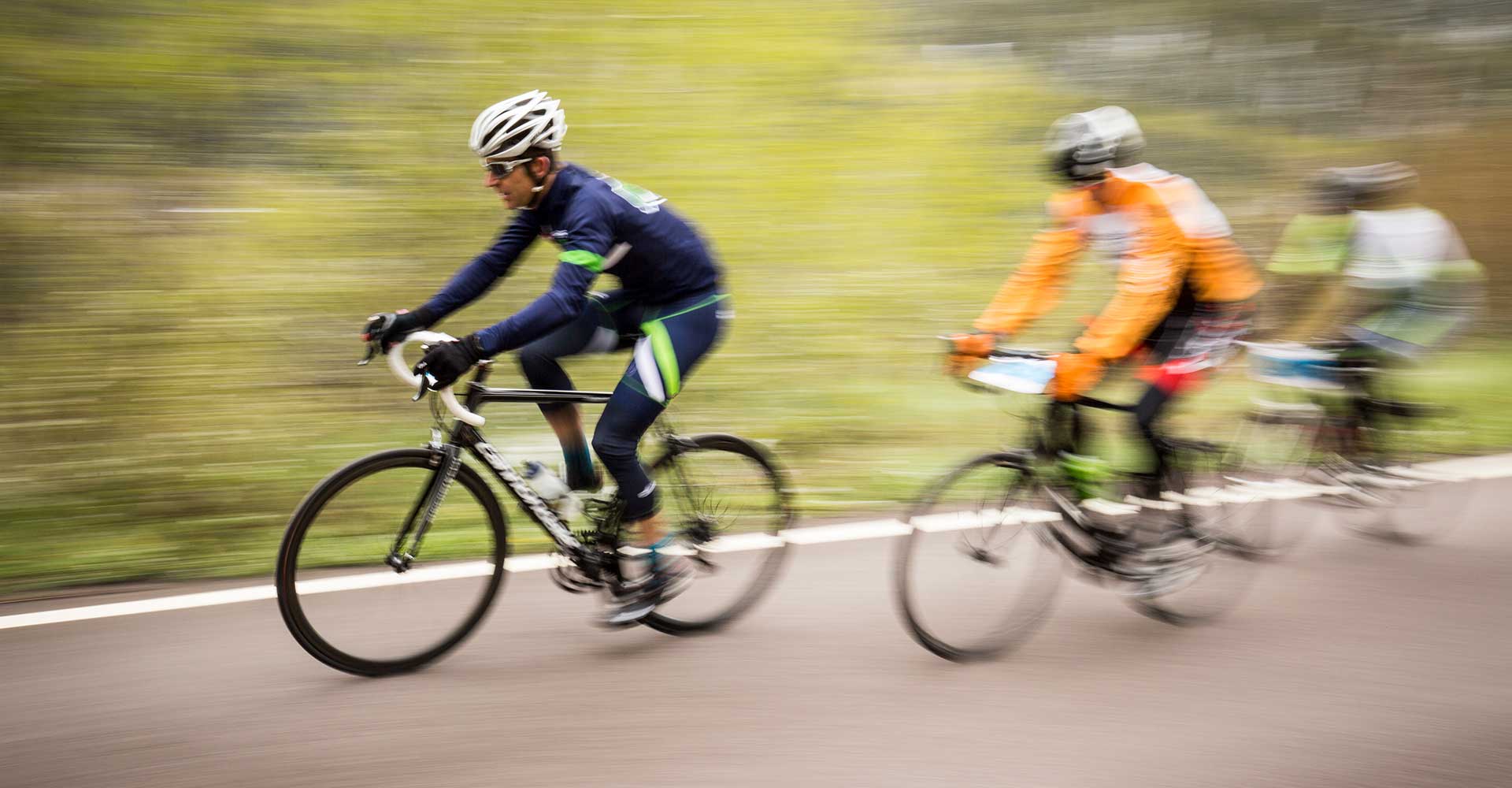
Road cycling near Aspen
Renting a bike should be as easy as riding a bike. From kids just starting out to seasoned downhillers, we have the right bike for you.
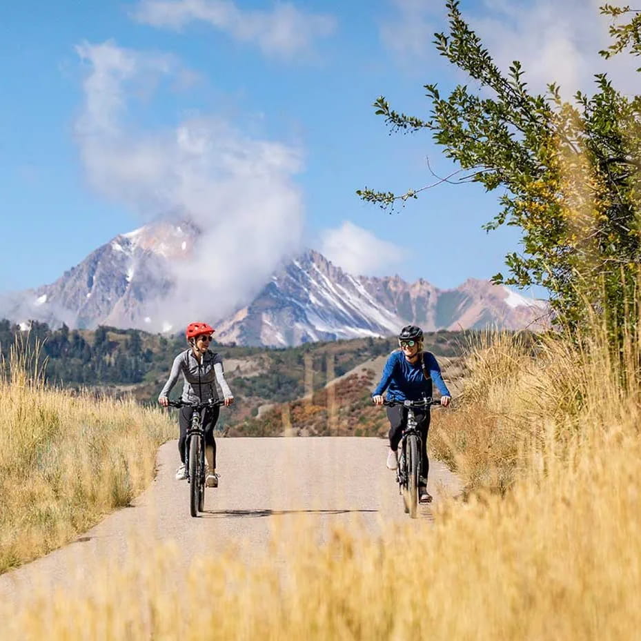
Routes From Snowmass Village
Snowmass Base Village > Aspen (Via Owl Creek)
Distance: 9.8 miles | Difficulty: Easy to Moderate | Elevation Gain: Minimal (mostly downhill) | Type: Paved trail
Best for: Families, casual riders, downhill cruisers
Terrain: Mostly downhill with scenic uphill stretch
This route is detailed above in our "Routes from Aspen" section, but if you are starting in Snowmass Base Village, note that the ride to Aspen via Owl Creek Road is mostly downhill. There is a short and scenic uphill stretch just beyond Two Creeks. For much of the ride, you are on the Owl Creek Trail bike path.
Snowmass Base Village > Aspen (Via Brush Creek)
Distance: 10.8 miles | Difficulty: Easy to Moderate | Elevation Gain: Minimal (mostly downhill) | Type: Paved trail
Best for: River scenery, scenic cruising
Terrain: Mostly downhill with steady climbing sections
This pleasant ride down to Aspen is a smidge longer (1 mile) than the Owl Creek Route, but it too follows a bike path for much of its way. Once you've reached the Brush Creek & Highway 82 parking lot for RFTA, look for the Aspen Mass Trail to quickly connect with the Rio Grande Trail for the ride up valley.
Snowmass Base Village > Woody Creek Tavern
Distance: 7.3 miles | Difficulty: Easy | Elevation Gain: Minimal | Type: Paved multi-use path
Best for: Half-day rides, families, casual diners
Terrain: Mostly flat with easy coasting
This relatively easy, 7.3-mile bike ride is perfect for a half day of sun, coasting, and lunch at the quirky and iconic Woody Creek Tavern. The log-cabin style restaurant has plenty of outdoor seating and an extensive menu.
Woody Creek Tavern > Snowmass Base Village
Distance: 7.3 miles | Difficulty: Moderate | Elevation Gain: 500 feet | Type: Paved multi-use path
Best for: Return riders, climbers, post-lunch workouts
Terrain: Brief scenic river stretch, then steady climb
The ride back to Snowmass Village from the Woody Creek Tavern follows a brief but scenic stretch of the Roaring Fork River before climbing up to the Brush Creek-Highway 82 Intercept lot, where riders hook back up with the Brush Creek Bike Path. From here, the climb is steady, but gloriously scenic, to Snowmass Base Village.
Road biking near Snowmass
Snowmass Base Village > The Tipsy Trout (Basalt)
Distance: 19 miles | Difficulty: Easy | Elevation Gain: Significant descent, then mild climb | Type: Paved trail
Best for: One-way adventures, dining, scenic cruising
Terrain: Descends from Snowmass, then mostly flat to Basalt
This pleasant 19-mile ride descends substantially from Snowmass Base Village, down the Brush Creek bike trail to the Rio Grande Trail and eventually Basalt, where you can lunch at the riverside café, The Tipsy Trout. From here, Four Mountain Sports can pickup rental bikes in the event you want to return to Snowmass Village by shuttle or RFTA bus.
The Tipsy Trout > Snowmass Base Village
Distance: 19 miles | Difficulty: Moderate to Challenging | Elevation Gain: 1,389 feet | Type: Paved trail
Best for: Strong riders, full-day adventures, return cyclists
Terrain: Mostly flat with steady climbing back up
If you’re feeling strong and want to bike back to Snowmass Base Village, this climb is among the most rewarding from purely a cardio standpoint. The final stretch from Highway 82 to Snowmass Base Village via the Brush Creek Bike Path will make you earn whatever plans you have for dinner, with a progressively steeper climb beginning about 12 miles in.
Snowmass Base Village > Lenado
Distance: 15.5 miles | Difficulty: Challenging | Elevation Gain: 1,200 feet (net) | Type: Paved trail, unpaved road
Best for: Strong riders, wilderness access, solitude
Terrain: Downhill start, then steep climb to remote valley
Looking for a strenuous workout option? This ride from Snowmass Base Village to the settlement of Lenado — tucked in the upper reaches of the scenic Woody Creek Valley — offers riders a nice, steady downhill at the start followed by a heart-pumping 1,200-foot climb from the Roaring Fork River to the small, woodsy settlement. In total, 15.5 miles of riding are earned. As noted above, the cell reception is minimal in this valley, so plan accordingly.
Lenado > Snowmass Base Village
Distance: 15.5 miles | Difficulty: Moderate | Elevation Gain: Minimal (mostly downhill start) | Type: Paved trail, unpaved road
Best for: Strong descenders, scenic return rides, full-day adventures
Terrain: Long descent, then climbing back up
The return to Snowmass Base Village from Lenado is practically a mirror-image of the ride there in terms of elevation gain and loss. Lenado sits only a few feet higher in elevation than Snowmass Village, so this 15.5-mile return journey starts with a long descent of 1,200 feet, before you end your day climbing back up to Snowmass Base Village along Brush Creek Road.
Bike Route FAQs
What's the easiest bike route in the valley?
Aspen to Woody Creek Tavern (7.8 miles) is nearly flat downhill the entire way. Rio Grande Trail sections are also consistently easy and family-friendly.
What's the most challenging route?
Which routes are best for families with kids?
What time of year is best for biking?
Are there elevation concerns?
Can I rent a bike for the day?
Yes. Four Mountain Sports has five locations with cruisers, e-bikes, mountain bikes, and road bikes. One-way rentals available. Aspen Collection offers an elevated set of rentals, including road and gravel bikes, and a variety of electric bikes.