Aspen Trails: 5 Hikes with the Best Views

Who gets the right of way? Uphill hikers have the right of way over other hikers.
Updated July, 2026
Nothing refreshes the soul like a walk through the woods—or the view from that mountain summit as you take it all in from the top. Once you've done these hikes in Aspen Snowmass, you'll agree that some of the best vistas around here are seen on foot.
Skip the Inclune
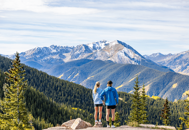
Want to take advantage of the big views of Aspen Snowmass without committing to the climb? Ride the Gondola to the top and enjoy a more leisurely hike with all the views, and grab a bike at Elk Camp or Sundeck at the end.
Smuggler Mountain Trail
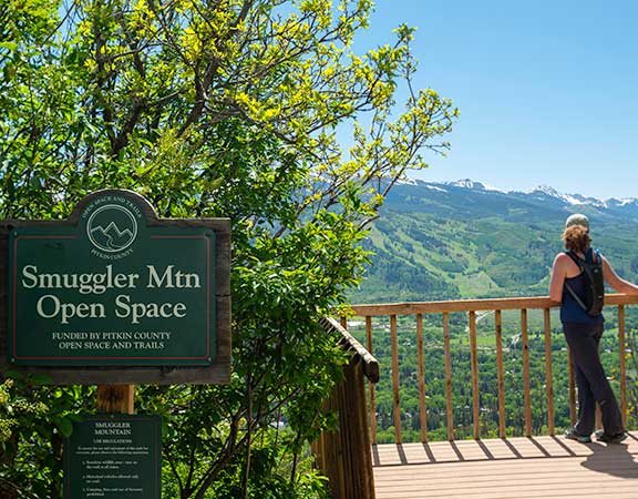
A popular "in town" fitness hike for locals, Smuggler Mountain Trail is short and rewards you with views straight down onto Aspen and across to Aspen Mountain. The trail is a dirt road with a half-dozen switchbacks leading to a long, gently curving cut that ends at a turnout with a small observation deck.
Difficultly: Moderate
Length: 3.0 miles round trip to the Smuggler Mountain overlook
Elevation Gain: 800 feet
Trailhead: Follow Highway 82 (Cooper Street) east out of town. Fifty yards after crossing the bridge, turn left onto Park Avenue. Where this street curves left, turn right toward the mountain on Park Circle.
Ute Trail
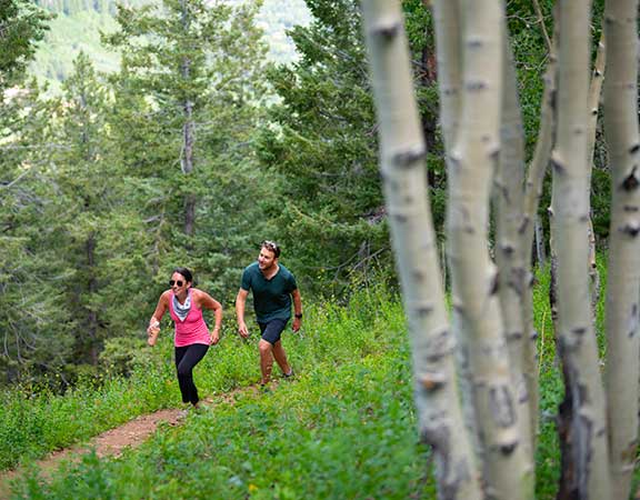
Difficulty: Difficult
Length: 2.4 miles round trip
Elevation Gain: 1700 feet
Trailhead: Travel east on Main. As the street makes a turn to the right, it becomes Original and turns south toward Aspen Mountain. Where Original ends, make a sharp left onto Ute Avenue. Continue to the trail sign. A parking area is opposite the trailhead.
Sunnyside Trail
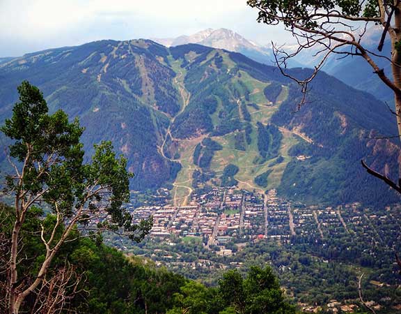
Difficulty: Moderate
Length: 4.8 miles round trip to antennas in woods
Elevation Gain: 1700 feet to the antenna towers
Trailhead: Head west on Main Street. Turn right on Cemetery Lane (just past the Castle Creek Bridge) and drive 1.1 miles to a parking area near Slaughterhouse Bridge. The trailhead is across the street.
The Rim Trail
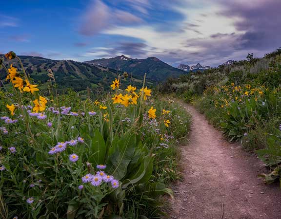
Difficulty: Moderate
Length: 7.1 miles for full one-way trip
1.3 miles from South Trailhead to Spiral Point
South Trailhead: From Aspen take Hwy 82 west to Brush Creek Road and make a left towards Snowmass Village. Take Brush Creek Road for 5.3 miles and make a right onto Co 10 Road. The trailhead is on your right.
North Trailhead: From Aspen take Hwy 82 to Brush Creek Road and make a left towards Snowmass Village. Take Brush Creek Road for 4 miles then turn right onto Horse Ranch Drive. Turn left to stay on Horse Ranch Drive then turn right on Trail Rider Lane.
Best Trails for Sunset Views
Timing turns a good view into an Aspen sunset worth planning around. Sunnyside Trail's open, west-facing switchbacks and the Rim Trail's wide-open shots of the Maroon Bells-Snowmass Wilderness are both built for golden hour—aim to be near the top as the light drops.

Fuel Up
Need a bite to refuel after your hike? The Aspen Valley offers a variety of dining, from family friendly spots to fine dining, both on and off the mountain.
Off The Beaten Path: Capitol Creek Trail
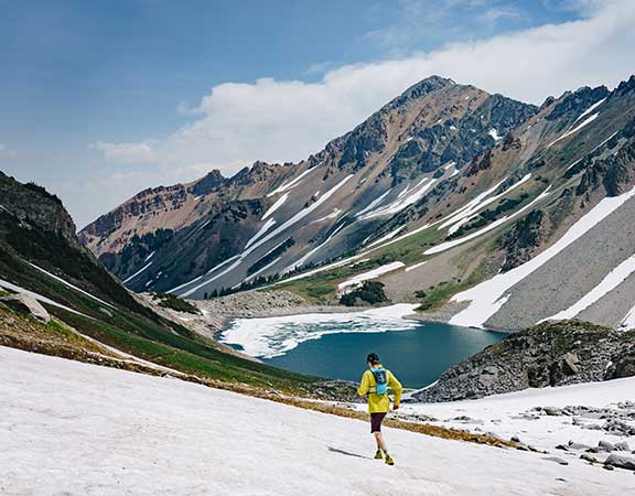
Through beautiful forests of aspen and evergreens, gorgeous views of Capitol Peak will guide your way. If you’re really feeling ambitious, pack your tent and sleeping bag for an overnight stay at Capitol Lake. Otherwise, do the ‘loop’. Start along the Upper Capitol Creek Trail #1963 (ditch trail) then cross the stream about 3.3 miles up and head back down Capitol Creek Trail #1961.
Capitol Lake – Difficult
Length: Capitol Creek Loop - 6.6 miles round trip.
Capitol Lake Trail - 12.8 miles round trip.
Elevation Gain: Capitol Creek Loop - 1,500 ft.
Capitol Lake Trail - 2,105 ft
Trailhead: Drive 14 miles west of Aspen on Highway 82 to Old Snowmass and turn left onto Snowmass Creek Road next to the Conoco gas station. Continue 2 miles to the "T" intersection. Take the right turn and continue 5 miles until the pavement ends. Follow the dirt road about 3 miles to the trailhead. The last mile is on a 4WD road. You MUST have 4 Wheel Drive to access the trailhead.
Looking for Maroon Bells hikes?
Check out our dedicated guide to the most photographed landscape in Colorado.

Looking for More Thrill?
If hiking isn't quite getting your adrenaline pumping, try taking a spin at downhill biking at Snowmass Bike Park. Bike rentals and clinics available to hone your skills while you expand your summer adventure.
Before You Go...
- Wear comfortable, supportive shoes with properly fitting socks
- Layer your clothing and prepare for sun, rain and cold
- Carry extra water to drink at regular intervals
- Bring snacks to fuel your energy
- Apply sunscreen
Aspen Snowmass Hiking FAQ's
What are the best hikes in Aspen, Colorado?
Smuggler Mountain Trail, Ute Trail, Sunnyside Trail, The Rim Trail, and Capitol Creek Trail are five of the best hikes in Aspen for views, ranging from easy in-town walks to strenuous, 4WD-access-only routes.
What are the easiest hikes in Aspen with great views
If you really want to maximize your views with an easier hike, Aspen or Snowmass Sightseeing access allows you take the gondola to the top of our mountains, and enjoy walks and hikes from the top. And gives you a good spot to grab lunch after you stretch your legs.
Smuggler Mountain Trail and Sunnyside Trail are both rated moderate and accessible right from town, making them the most approachable options with big payoff views.
What is the most popular hiking trail in Aspen?
Smuggler Mountain Trail is one of the most popular in-town fitness hikes for locals, thanks to its short distance and views of Aspen and Aspen Mountain.
Where can I watch the sunset in Aspen?
Sunnyside Trail and The Rim Trail are both well-positioned for sunset, with open, west-facing views over the Roaring Fork Valley and the Maroon Bells-Snowmass Wilderness.
Are the Aspen hiking trails good for beginners?
Yes — Smuggler Mountain Trail and Sunnyside Trail are moderate routes with maintained dirt paths, making them solid starting points for less experienced hikers.
How difficult is the Smuggler Mountain Trail?
It's rated moderate: 3.0 miles round trip with 800 feet of elevation gain, following a dirt road with a handful of switchbacks.
What is the best time to hike in Aspen for sunset views?
Early evening in summer, when the light is low and golden — Sunnyside Trail and The Rim Trail both catch the best of it heading into an Aspen sunset.