From the second pass, Frigid Air, Fravert Basin can be seen below. The trail descends through an alpine field and enters a spruce forest heading toward the North Fork of the Crystal River. Along the river, there are several campsites (always remember to camp at least 100 feet from the stream). After another 1.5 miles, the trail begins a series of steep switchbacks adjacent to the stream—also a stunning waterfall with high water.

Top Aspen Hike: The Four Pass Loop
The Four Pass Loop is one of the most popular hikes in Aspen and a quintessential Colorado backpacking trip, traversing high alpine passes, wildflower-filled basins, and pristine blue lakes, covering more than 27 miles and nearly 8,000 total feet of elevation.
Runners often go counterclockwise, so they can get the two big climbs out of the way early on while backpackers and hikers generally travel clockwise.
Updated August, 2023
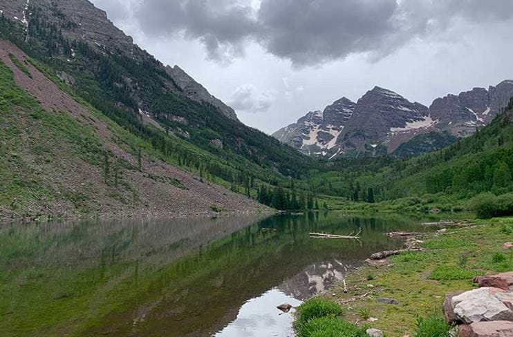
Feeding (and testing) the soul, the popular Four Pass Loop circumnavigates the iconic Maroon Bells peaks and crosses four mountain passes: West Maroon (12,500 feet), Frigid Air (12,415 feet), Trail Rider (12,420 feet), and Buckskin (12,500 feet). It’s typically a three- to four-day backpacking trip done clockwise, but can also be done in the opposite direction. Ambitious trail runners also tackle the loop in one day, without the weight of packs, which aids them in moving quickly on their feet as they run up and over the passes.
Getting There And Back
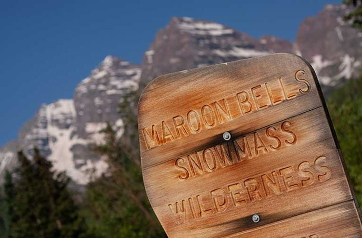
The trailhead starts at Maroon Lake and the entrance to the Maroon Bells-Snowmass Wilderness Area. The protocols for parking have changed from previous years—reservations are now required for shuttles to Maroon Lake and for overnight parking. You can reserve a parking space for vehicles up to 20 feet for $10, or for free with the America the Beautiful and the Maroon Bells Annual Passes. You can also take a shuttle—as a roundtrip or one-way—which leaves from Aspen Highlands Village multiple times a day and also requires a reservation.
Be sure to make your reservations in advance as spot fill up quickly!
On The Trail
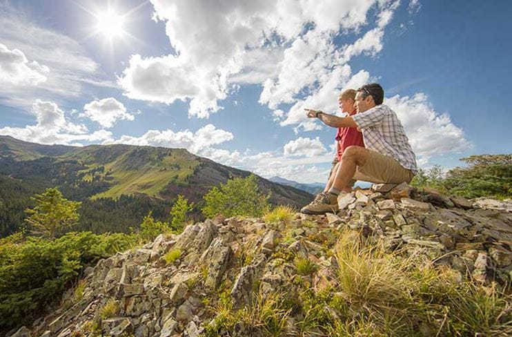
The hike starts at 9,580-feet at the Maroon Lake trailhead with the Maroon Bells front and center. The first 1.8 miles to Crater Lake climbs through giant aspen groves and pines. Because this part of the wilderness area provides access points to many of the surrounding 14ers and different trails around the iconic Maroon Bells, it can be very crowded. However, crowds normally dissipate after Crater Lake.
Runners often go counterclockwise, so they can get the two big climbs over Buckskin Pass and Trail Rider Pass out of the way early on before going over Frigid Air third, creating less of a climb up to the final pass, West Maroon, at the end of their big day. Backpackers generally travel clockwise, the most common route, gaining some of the best views in the later part of their trip.
Going clockwise, the long yet moderate climb up West Maroon Creek is stunning. The trail meanders along the creek before popping into high-alpine tundra above the tree-line. West Maroon Pass is known for some of the most breathtaking and colorful wildflowers in the area, especially from mid-July to August. The last mile to the first pass is a set of steep switchbacks, but the view at the top is the reward. There are also some campsites in this area.
From here, the trail descends quickly and in one mile, intersects with Frigid Air Pass. Take a right (other hikers will continue to Crested Butte by staying on the main trail) and ascend for about one mile, and Frigid Air Pass can be seen high above, reached by a series of steep switchbacks.
To Fravert Basin
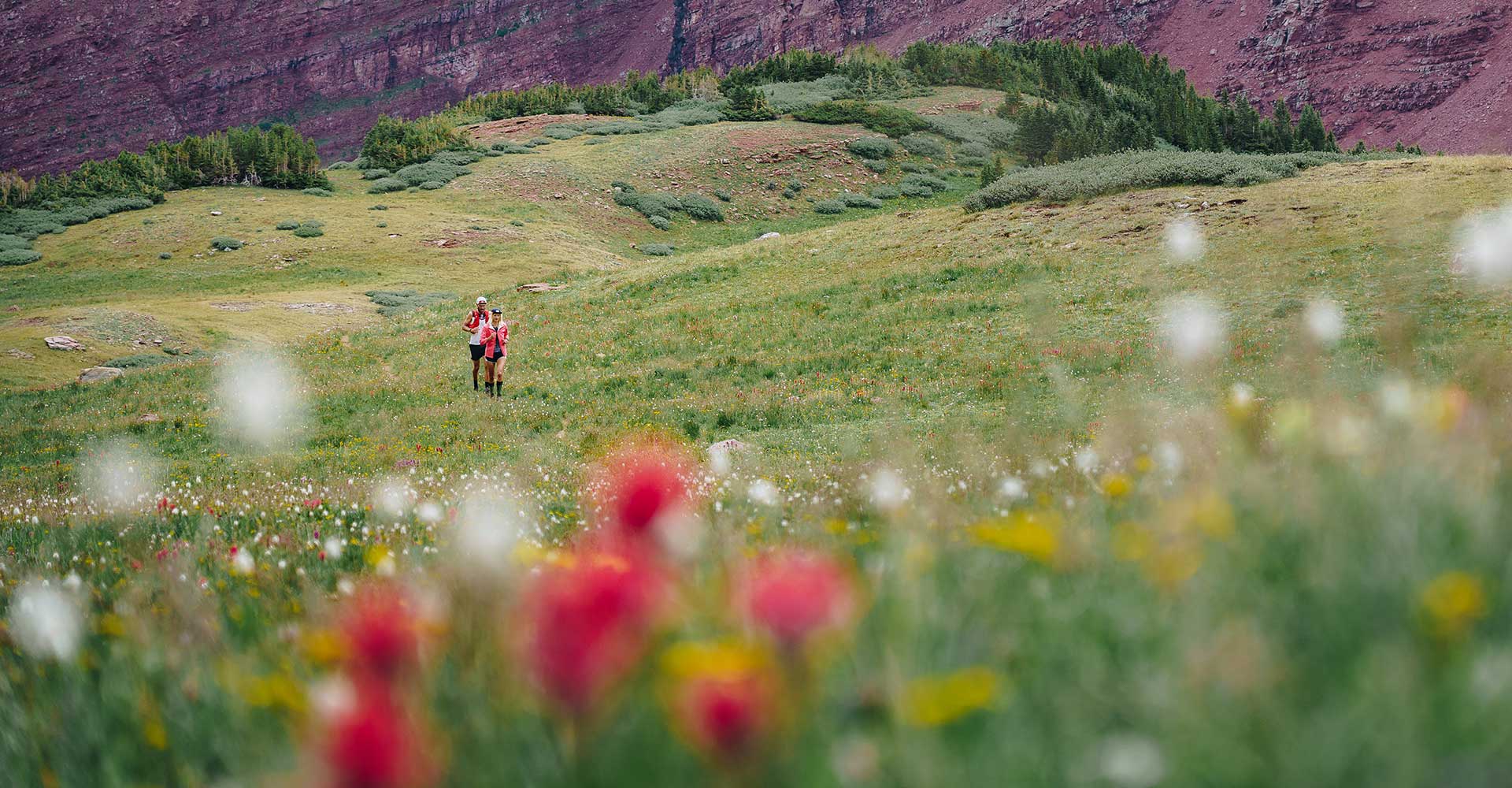
Flowers galore in the Maroon Bells-Snowmass Wilderness
In another mile, the trail forks just after a small clearing. Take the right branch for 0.75 of a mile, after which the trail forks again. Take the right fork toward Trail Rider Pass—it will begin to climb again before veering off to the left for Geneva Lake. Hike up and up until the third pass, Trail Rider, is reached. From here, Snowmass Lake is visible below.
A breathtaking descent delivers hikers to Snowmass Lake. Opt to camp at the many sites here, or continue on the loop by getting on the Maroon-Snowmass Trail and heading toward Buckskin Pass. After crossing Snowmass Creek, the trail ascends to the final pass. There is some camping about halfway up here—keep in mind there is nothing until the other side of Buckskin Pass in the Minnehaha Gulch area. At the top of Buckskin Pass at about 12,000 feet, the views are spectacular; the Maroon Bells share the ridge and Pyramid Peak can be seen across the valley. And then, as they say, it’s all downhill from there, until you return to Crater Lake and back down to the Maroon Lake trailhead.
A breathtaking descent delivers hikers to Snowmass Lake. Opt to camp at the many sites here, or continue on the loop by getting on the Maroon-Snowmass Trail and heading toward Buckskin Pass. After crossing Snowmass Creek, the trail ascends to the final pass. There is some camping about halfway up here—keep in mind there is nothing until the other side of Buckskin Pass in the Minnehaha Gulch area. At the top of Buckskin Pass at about 12,000 feet, the views are spectacular; the Maroon Bells share the ridge and Pyramid Peak can be seen across the valley. And then, as they say, it’s all downhill from there, until you return to Crater Lake and back down to the Maroon Lake trailhead.
Overnight Permits
Advance reservation overnight permits are required for the busiest areas of the Maroon Bells-Snowmass Wilderness including Conundrum Hot Springs, Capitol Lake, Crater Lake, and the Four Pass Loop (including Snowmass Lake and Geneva Lake). Permits must be purchased in advance at recreation.gov.
For overnight trips outside of these areas, free self-registration is required. For more information, see here.
For overnight trips outside of these areas, free self-registration is required. For more information, see here.
Quick Tips
Thunderstorms
Plan hikes early in the day to avoid afternoon thunderstorms. Remember to pack appropriately and be prepared for all conditions and events.Leave No Trace
Don’t leave anything behind. This is a fragile high alpine ecosystem and is already suffering because of overuse. Pack out all trash, and bury human waste 6–8 inches deep and at least 100 feet away from the trail.Dogs
Dogs are permitted but must be leashed, and you must carry out all dog waste. This is a strenuous hike and should only be attempted dogs (and people!) with backpacking experience.Bears
Bear activity is common in this area. Certified bear-proof containers are required for overnight trips, so be sure all your food, drinks, and cooking utensils fit in your canister before you depart.Stream and Snowfield Crossings
Stream crossings can be dangerous during runoff periods. Consider bringing waterproof shoes to cross streams and make sure to unbuckle your pack so it won’t weigh you down if you fall. Depending on how early in the season you're hiking, there can also be snowfields to cross, so be prepared if you feel you’ll need hiking poles or microspikes for your boots or running shoes. You can check trail conditions and recent reviews on sites like All Trails to be prepared.Note: This is not an official trip guide. Please visit the US Forest Service website or office for thorough trail descriptions, and remember to pack a map and directional tools as well.