Top 6 Fall Hikes In Aspen

August 19, 2022

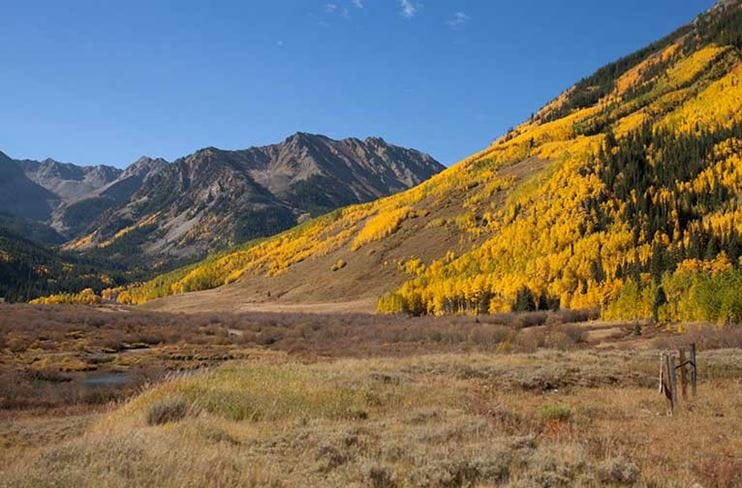
East of Aspen
Length: 6.3 Miles (or less, if desired)
Elevation: 269 feet
Surface: Paved roads, gravel trails
For those looking for an easy stroll close to town, the East of Aspen Trail (complete with the East of Aspen Extension, if desired) is a perfect choice for expansive views. Sights entail the high peaks of Independence Pass and valley walls painted with hues of greens, reds, and yellows. Starting from town, continue up the sidewalk that parallels Highway 82 for about a mile until a dirt path veers to the right over the river. The path follows the Roaring Fork River for three miles until it reaches Difficult Campground. If a six to eight mile out-and-back is not in the cards, driving to the start of East of Aspen Extension and catching the last mile and a half to Difficult is a great option as well!
Hunter Creek Valley
Length: 5.2 Miles
Elevation: 1,161 feet
Surface: Gravel road, dirt trail, rocky trail
If a longer day on the trails is in order, Hunter Creek Valley stands as a great option. You’ll hike Smuggler Mountain Road, which offers stellar vistas over town and Aspen Mountain and takes you through dense aspen clusters, leading into the abandoned mining valley of Hunter Creek. Feel free to wander around here as long as you’d like, but make sure to save energy for the way down.
American Lake
Length: 6.8 Miles
Elevation: 2,063 feet
Surface: Dirt trail, scree
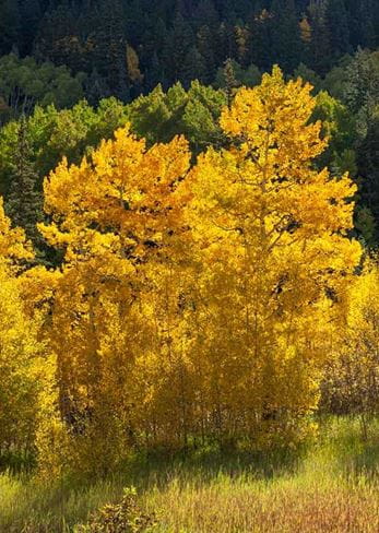
One of the classic hikes up the Castle Creek Valley is this out-and-back trail to American Lake. The start of the three-mile, 2000-foot ascent is a series of switchbacks through what could be the most beautiful Aspen grove in the valley. After the aspens (take your time peeping), more coniferous environs await, leading to scree fields, and finally, the stunning high-alpine American Lake. In the fall, there may be snow on the surrounding peaks, and the temperatures at this higher elevation tend to be on the cooler side, so remember to pack and layer appropriately.
Sunnyside
Length: 10.8 miles
Elevation: 2,683 feet
Surface: Dirt trail
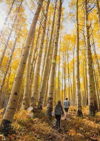
Featuring one of the largest groves in the valley, Sunnyside is a favorite of both hikers and mountain bikers. The trail, aptly named, receives some of the last light in the valley and makes for a lovely afternoon hike, with views of all four Aspen Snowmass mountains and the surrounding fourteeners. Starting from either the Rio Grande trail or McLain Flats Road, Sunnyside begins ascending at a fairly steep pace, but soon mellows out to a sustained pitch. Once you’ve gone about five miles, you’ll be at the Four Corners junction, which marks the spot where you should turn, take in the views, and savor the way down.

Government Trail
Length: 10.5 miles
Elevation: 2,193 feet
Surface: Dirt road, dirt trail
The trek from Buttermilk to Snowmass Village is one all avid hikers should do once in their life. It crosses through distinct ecosystems including thick aspen groves, pine forests, wetlands, and open meadows. Starting from Tiehack Road, you’ll wind up Buttermilk, hit the Government Trail before crossing Owl Creek, and then drop into the Snowmass side, which lands you at the Snowmass Mall. Take a RFTA bus back to Aspen, or have a friend shuttle you back to your car at Tiehack.
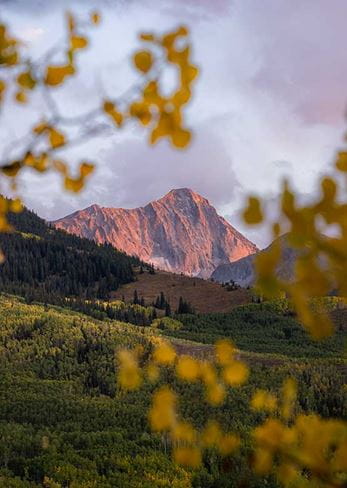
Capitol Lake
Length: 13 miles
Elevation: 3,100 feet
Surface: Dirt trail, scree
This could be one of the most awe-inspiring views around; Capitol Peak juts out above Snowmass valley like a shark fin, and serves as the cairn for your big hike up to the lake. The 6.5-mile ascent with an elevation gain of roughly 2,200 feet out and 900 feet on the way back is easily accomplished over one day when starting from the Capitol Creek Trailhead past Old Snowmass. A 4x4 vehicle with high clearance is a must to get there, but the drive through the road’s flittering Aspens could be worthwhile on its own.